

On this page you can find some information and pictures of the surroundings of the Camargue and the Alpilles, The Bouches du Rhone, the Rhone delta and the Cote Bleue:
–Port Saint Louis du Rhone,
–Camargue,
-Embouchure du Rhone,
-Alpilles and
-Chaine de L’Estaque (Cote bleue).
(departement 13, Bouches-du-Rhone, France)
For more info about Port Napoleon (Marina), click here.
 Fos-sur-Mer, Pointe de St. Gervais, sunset
Port Napoleon surroundings
 They de la Gracieuse is the low bank on the E side of the River Rhone, which extends 4.5 miles NE of the river mouth. Several stranded wrecks lie close to the shore of this bank. The bar at the mouth of the River Rhone advances about 50m seaward each year.
9.16 The coastal shoal off They de la Gracieuse is marked by lighted buoys moored about 0.5 mile N, 1.2 miles SSE, and 2.5 miles S of the NE extremity of the bank. In addition, Lighted Buoy GE, equipped with a racon, is moored about 0.5 mile E of the NE extremity of the bank.
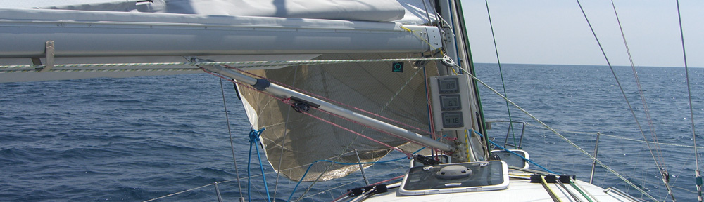
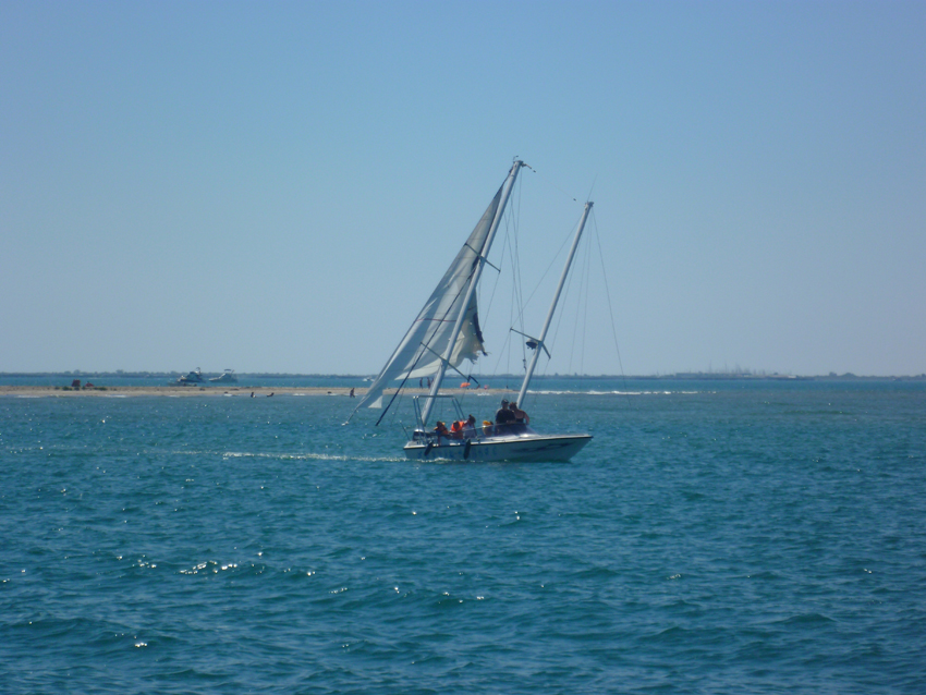
Anchoring is possible on the W of the bank, but first you need to pass the bank, and not try a shortcut like the boat in the picture above…
The climate of the Camargue can be harsh, ranging from scorching heat in summer, sometimes with 100% humidity, to desiccating cold whipped by icy winds from the Alps in winter. But mostly in the spring and summer period the climate is okay from our experience.
The area is also subject to the famous Mistral wind. blowing from the north- north-west down the Rhône Valley. The strongest Mistral winds are in this area.
 Camargue, between They de la Gracieuse and Plage Napoleon
 The Camargue is a triangular area lying on the coast between the Languedoc-Roussillon and Provence. It is a river delta where the Rhône meets the sea – a marshy island bounded by two branches of the Rhône and the Mediterranean Sea. With an area of over 930 km² (360 sq. miles), the Camargue is western Europe’s largest river delta, with exceptional biological diversity, and home to unique breeds of Camargue Horses and Camargue Bulls, and to more than 400 species of birds including Pink Flamingoes.
 Much of the area is under water – inland salt water lakes, called étangs in the Languedoc. Approximately a third of the Camargue is either lakes or marshland. The largest of these salt water lakes is the The Étang de Vaccarès. Established as a national park and nature reserve in 1972, the Parc Régional de Camargue covers 820 km² including some of the wildest and most protected in Europe. It is a major world heritage wetland. A roadside museum provides background on flora, fauna, and the history of the area.
In all, the Camargue covers around 140,000 hectares, including wetlands, pastures, dunes and salt flats.
The salt water lagoons are surrounded by sand dunes. Originally sculpted by the wind they are now man-made – at least around Salin-de-Giraud. They are where salt is produced – dried by the sun and wind in immense spaces called “salins”. This salt was a source of great wealth for the so-called “salt abbeys” of Ulmet and Psalmody in the Middle Ages. The salt industry started up again in the nineteenth century and big chemicals companies founded the salt extraction city of Salin-de-Giraud. Today, evaporation pans at Salin-de-Giraud – the largest in Europe – extend over 11,000 hectares and produce some 1,000,000 metric tons a year, Sodium and chlorine from the salt are used in many chemicals and pharmaceuticals. Low-lying salt plains (sansouires) dry out and crack in summer. They are carpeted with glasswort (grazed by the wild bulls and Camargue horses). These plains are submerged in winter but in the spring they re-emerge as wetlands for marsh birds such as black-winged stilts, godwits, and sandpipers.
 An area covering 85,000 hectares of the Camargue was designated as a nature reserve in 1927. This area was granted National Park status in 1970. Efforts are now made to maintain the fragile equilibrium between the indigenous ecosystems on the one hand and human activities (tourism, agriculture, industry and hunting) on the other.
The north of the Camargue is mainly agricultural land. Main crops are cereals, grapevines and rice.
The centre and south of Camargue is a more natural area, characterised by a brackish saline ecosystem. Flora of the Camargue is adapted to these conditions. Sea lavender and glasswort flourish along with tamarisks, reeds, juniper trees, wild irises wild rosemary. The juniper trees growing to a height of 6m form the woodland on the islands between the Étang du Vaccarès and the sea (Bois des Rièges).
Plage Napoleon The Napoléon Beach with its 10 km long beach of fine sand will bring you on the left to the tip of the Gracieuse or on the right to the mouth of the large Rhône.
 Plage Napoleon, looking at the Calanques
Plage Napoleon, the Embouchure du Rhone
 Embouchure du Rhone


 entrance of the canal to Port Napoleon in morning clouds, november
 Port Napoleon, Anse du Carteau
 Port Napoleon, Anse du Carteau
Marais du VigueiratMarshes
A system of channels and pumps enables water levels and their salinity to be monitored, and to preserve the Camargue’s diverse ecosystems. Purple and grey herons, mallards, northern lapwings, black-winged stilts, moustached warblers and many other birds have made this marsh their home. (pictures follow)
 Port Saint Louis-du-Rhone, former lighthouse
The tower provides the visitors exceptional views of the Camargue, Saint-Louis canal, the salt marshes and the windmills. That is the unique point of view from the town, opened to the public, free access will be given to the telescope.
Wild land, hit by all winds, Port Saint Louis is the ideal spot for all windsurfing and kitesurfing lovers. The town welcomes the world international championships since 2006.
Golfe de Fos / Fos-sur-Mer
Fos is the site of a major port development operated by the Autonomous Port of Marseilles. The facilities include container handling terminals and a gas (methane) terminal. The waterside location of the industrial zone is attractive to heavy industry including steel. The steel group ArcelorMittal has its Sollac Méditerranée plant here.
 Fos sur Mer, Petrol strike, october 2010
The Port of Fos-sur-Mer was first a small fishing and farming village, but it was transformed when a major industrial zone was built nearby in the 1960s. Despite the fact that Fos is mainly known for the huge Port, the old town located on a hill is certainly charming and worth a visit
 golfe de Fos sur Mer
 Autum 2010, with my twin sister and her 2 kids
Golfe de Fos / Cote Bleue / Martigues Martigues, sometimes called the ‘Venice’ of Provence (above and below)
Chaine de L’estaque / Cote Bleue The Cote Bleue is a stretch of coastline from Martigues to the L’Estaque district of Marseilles, with its deep narrow creeks (calanques), old fishing harbours and sand and shingle beaches.
Backing on to the Estaque chain, this listed and protected section of coastline nestles between the bay of Marseilles and the petrochemical industrial basin of Martigues.
It kept itself very much to itself until the opening in 1915 of a railway line that is still in use today, with the famous little Côte Bleue train. The road hugs the coastline before launching into narrow hairpin bends that drop steeply down towards the sea. The high white limestone cliffs offer stunning views of the sparkling Mediterranean.  Baye of Fos sur Mer seen from Carro (chaine de l’Estaque)
 Carro, Baye de la Couronne
La Couronne, or Cap Couronne is a beautyfull spot that is very popular with the people of Marseilles, drawn here by its beautiful and easily accessible beaches. Verdon beach from whose western end you can see the Cap Couronne lighthouse on Pointe Riche and, beyond, the bay of Marseilles as far as Cap Croisette. Cap Couronne abounds in molasse quarries; this pinkish beige stone has been exploited since antiquity, and it was from here that the Romans took what they needed to build the old port, the remains of which can be seen next to the Bourse (stock exchange). Carro, baye de la Couronne, anchoring and the harbour (below)
 Carro is a small port that dates back to antiquity and last stronghold of the Côte Bleue fishermen, remains the western Mediterranean’s second biggest port for old-style tuna fishing. The fish market attracts professionals, the young and the not so young, lazy cats and aggressive seagulls.
 Chaine de l’Estaque, looking at the Rade de Marseille
 Carry-Le-Rouet / Anse du Rouet
A former fishing village and now a rather chic seaside resort, Carry-le-Rouet is set in a beautiful location at the foot of wooded slopes. Inviting terraces of bars and restaurants line the quays of the marina, and there is a superb coastal walk which can be reached from the end of the P.-Maleville quay (on the right facing the harbour). It begins on a rocky spit with a red and white signal station and you can enjoy the view of the bay of Marseilles as you make your way along a route equipped with railings, benches, viewpoints and explanatory panels on cicadas, wall lizards and Aleppo pines. L’Estaque, Niolon looking towards Marseille and Frioul
 Niolon, the harbour seen from above
 Niolon, Looking at Marseille
 La Vesse, Port de la Vesse
 La Vesse
Port Saint Louis is situated near the embouchure du Rhone, and the Camargue Delta The Camargue the only place in France (and one of the few anywhere around the Mediterranean) where pink flamingos nest. The flamingo population can reach 20,000 couples grouped into flocks. They favour raised nests built out of mud.
Flamingoes eat mainly plankton, and are adapted to do so – much like baleen whales: they suck water in through their bills and expel it over fine filters in their mouths straining the plankton. It is this plankton, not as sometimes claimed crustacea, that are responsible for the flamingo’s pink plumage. 
 Plage Napoleon looking at the gulf of Fos and the Chaine de L’Estaque
Camargue Foods
Camargue beef. The meat of the Camargue bull is the only beef to have been protected by an ‘appellation d’origine contrôlée’ (registered designation of origin) in recent times. This meat comes from two breeds of fighting bull: the local Camargue bull (related to the Spanish fighting bull) and the ‘brave’ breed (descended from Camargue fighting bulls). Bulls are bred in the hills and plains of Lauragais, in the region of the Camargue, and in the mountainous regions of the Pyrenees, Aubrac, Cévennes and Margeride. Stuffed with Camargue rice, it is a speciality of Grau du Roi.
Ollada, or ouillade Beef stew.
Gardiane. A Camargue speciality, this is a ‘daube’ (a slow-cooked beef stew) made with bull’s meat. Cut into cubes and seared in olive oil, the meat is then added to the other ingredients: vegetables, black olives, garlic and smoked bacon, doused in red wine. This dish is usually served with Camargue rice.
Rice. The Camargue’s round and long varieties of rice account for a quarter of all rice eaten in France (it used to be three-quarters).
Tellinas. Tellinas or “sunset shells” are small shellfish that thrive in the sands of Camargue. They are cooked a la mariniere (ie with onions, herbs and white wine) or with persillade (chopped parsley and garlic)
 Bouillabaisse, a traditional Provençal fish stew
Camargue / Arles, the Capital of the Camargue
 Arles, seen from the Rhone

 Arles, Pont van Gogh
Salin de Giraud
With its vast open spaces that are home to herds of black bulls with distinctive curved horns, slender silhouettes of pink flamingoes and galloping white horses, the Camargue is a unique place. In this landscape the Salins the Giraud take a special place The Salins-du-Midi operated a sea salt production facility covering 11,000 hectares where an average of 800,000 tons of salt per year are harvested. A tourist train on tires will carry you around the saltworks between March and October at Salin de Giraud. The tour ends with a visit of the Salins-du-Midi salt museum..
www.salins.com

Salin de Giraud, Sea Salt winnings, accesable via the ‘Bac du Rhone’ Salin de Giraud, seen from above
Beauduc Close to the Beauduc lighthouse, Beauduc beach is located around twenty-five miles south of Arles. It can be reached from a track which begins in Salins-de-Giraud.
The hour-long journey is a true adventure in itself, a route along a bumpy trail that cuts through the marshes. Featuring heavily in Beauduc folklore, but in danger of soon disappearing as they have now been declared illegal, the local cabanons (small cabins) were built by visitors from Arles from the 1950s on. The cabanons can range from static caravans to small houses encircled by fences. The cabanier community has even been the subject of an ethnographic study!
The beach is a true paradise for surfers and kite-surfers. Feel free to pitch a tent and enjoy several days relaxing here, gathering tellines from the sea for an apéritif (don’t forget to bring fresh water), and eating around a barbecue. Since 2012 it is unfortunatly forbidden to stay at night in Beauduc.
 Plage de Beauduc, Camargue, free camping on the beach (this is unfortunatly no longer possible since 2012, because some people really made a mess the local authorities closed off Beauduc)
 Beauduc, preparations for how (not) to teach children sailing in an optimist with 8 BFT…
I discovered after that try-out, that the waves are not so high, but very steep, so I flipped over with the opti, planing down the waves….naturally my stepbrother forgot to attach the basic element to dry the boat after flipping over….;-)) After that, we were sandblasted by the Mistral…..
Alpilles, a mountain chain near Port Saint Louis du Rhone
 Alpilles, Orgon
Plan-d’Orgon is situated in the Bouches-du-Rhone department (Provence region) in the south-east of France at 64 km from Marseille, the department capital. (General information: Plan-d’Orgon is 597 km from Paris and 828 km from the port at Calais).
Popular places to visit near Plan-d’Orgon: these include Saint-Remy-de-Provence at 13 km and Oppede-le-Vieux at 14 km. Jardin de l’Alchimiste is a listed remarkable garden at 7 km and Glanum is a listed national monument at 13 km. Orgon, office de Police, history shows….
 Alpilles, near Mouries
 Alpilles, oppidium
 The Alpilles
 Les Beaux-de-Provence, in the Alpilles
Standing out from the Alpilles, the village of Les Baux is set on a stark rocky spur 900m long and 200m wide with vertical ravines on either side. A fortified castle, destroyed by Richelieu in 1632, continues to keep watch over the old stone houses which blend in so wonderfully with this extraordinary site. A magical experience is to be had strolling through the village streets (Place St Vincent, Hôtel Porcelet), as is taking in the view from the keep over the Aix region, Sainte Victoire, the Luberon, Mt Ventoux and the Cévennes. 

