Port Vendres Is a typical Mediterranean fishing port, situated near the Spanish border on the Côte Vermeille in south west France, Port-Vendres is renowned for its numerous fish and sea food restaurants.
Port-Vendres, a very old natural port that accommodates commercial, fishing, and leisure vessels, lies 1.3 miles WNW of Cap Bear and provides good shelter from sea and swell.
Port-Vendres is one of the few deep-water ports in this part of the French Mediterranean coast. It takes freighters and cruise ships, as well as large and small fishing boats which may be seen arriving with their daily catch.
 The geomorphology of Port Vendres meant that it developed in a different way from the nearby port of Collioure. Whereas Collioure has two beaches which slowly descend into a relatively shallow sandy-bottomed harbour, Port-Vendres is deeper and rockier. Port Vendres is a safe harbour under most conditions. Collioure and Port Vendres have therefore been used for different purposes – Collioure for small commercial ship and Port Vendres for larger vessels and military transports. During the 20th century, this made it a main point of embarkation for French troops going to serve in Algeria.
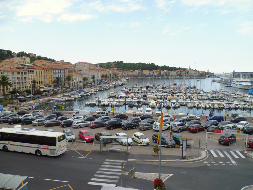 Port vendres marina
Even before it became an important harbour of the Kingdom of Majorca during the 13th century, Port-Vendres had already been known since the 6th century BC by Greek navigators as « Portus veneris » (the port of Venus). There has always been an important shipping activity in this natural shelter.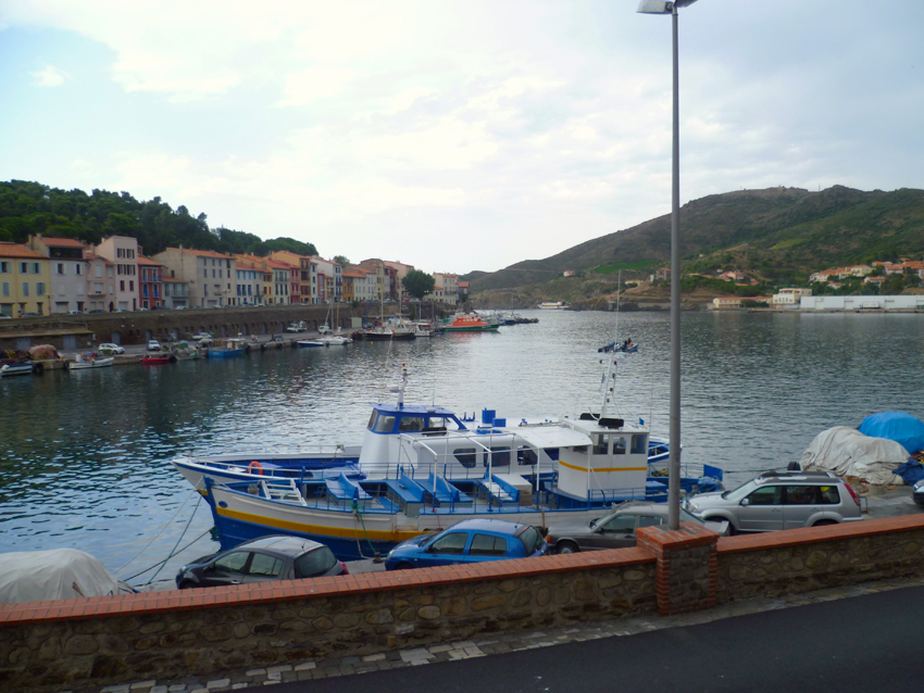 From 1838 on, when France got involved in economical exchanges with North Africa, the port was enlarged and improved. It enabled Port-Vendres to become an important commercial port (“the shortest crossing and the most sheltered waters”). Goods and passengers traffic flourished and increased until 1962.
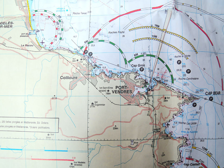
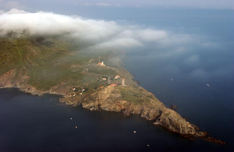
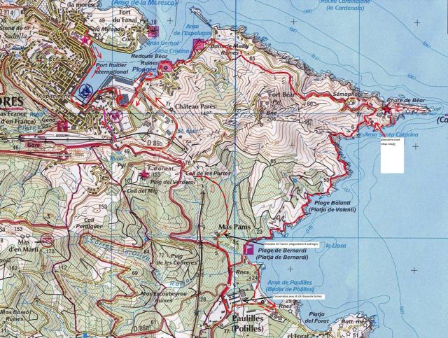
Cap Bear (42°31’N., 3°08’E.), located 5 miles NNW of Cap Cerbere, is the E extremity of a rocky promontory which terminates in a vertical black cliff, 9m high. The rugged terrain rises from this cliff to a height of 56m, about 0.3 mile inland. Fort Bear, an old fortress which is illuminated at night, stands on the summit of the promontory.
9.4 A light is shown from a pink square pyramidal tower with a red top, 27m high, standing 0.2 mile W of the extremity of the cape. A signal station, consisting of a prominent white building, is situated close W of the light.
Numerous wrecks lie within 6 miles of Cap Bear.
Due to the existence of submarine cables, an anchoring and trawling prohibited area, the limits of which are shown on the chart, lies in the vicinity of Cap Bear. The area is 1.5 miles wide and extends up to about 5.5 miles ESE of the cape, and up to 11 miles N of the cape.
 The South side of Port Vendres has some really beautifull walks
for more walks in the region you can visit this site
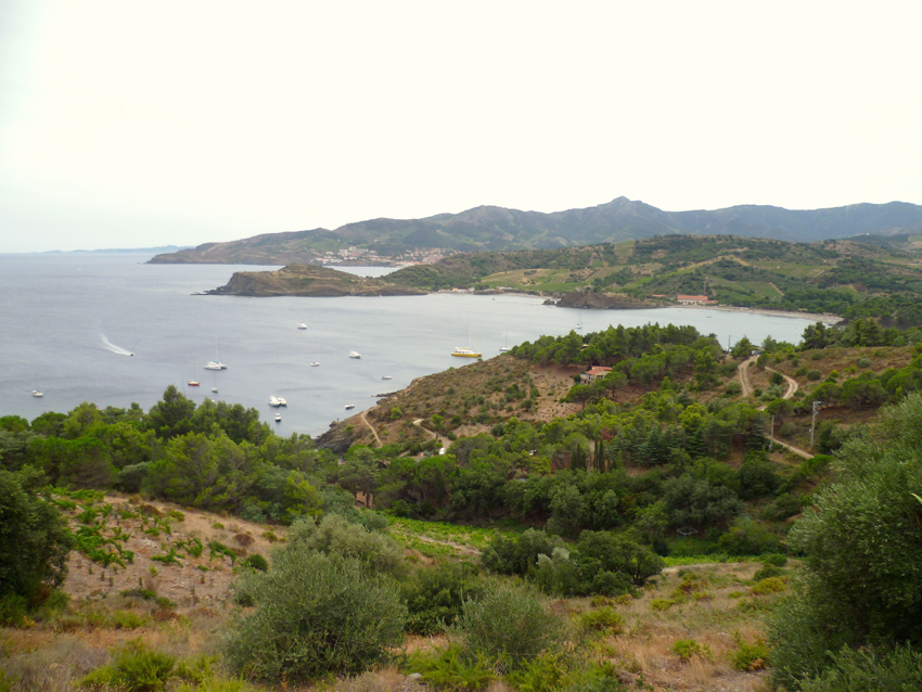
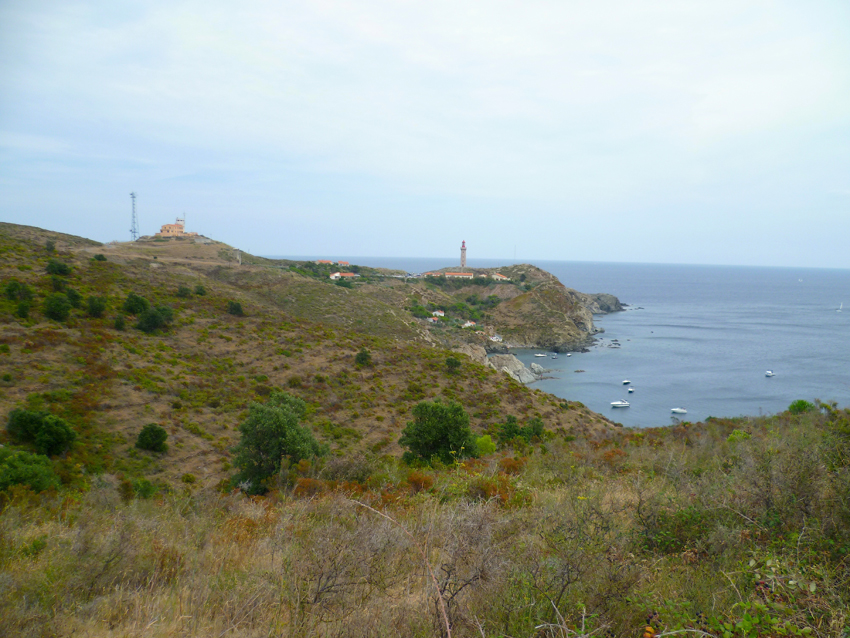 Cap Béar seen from the hills, this is the South Side
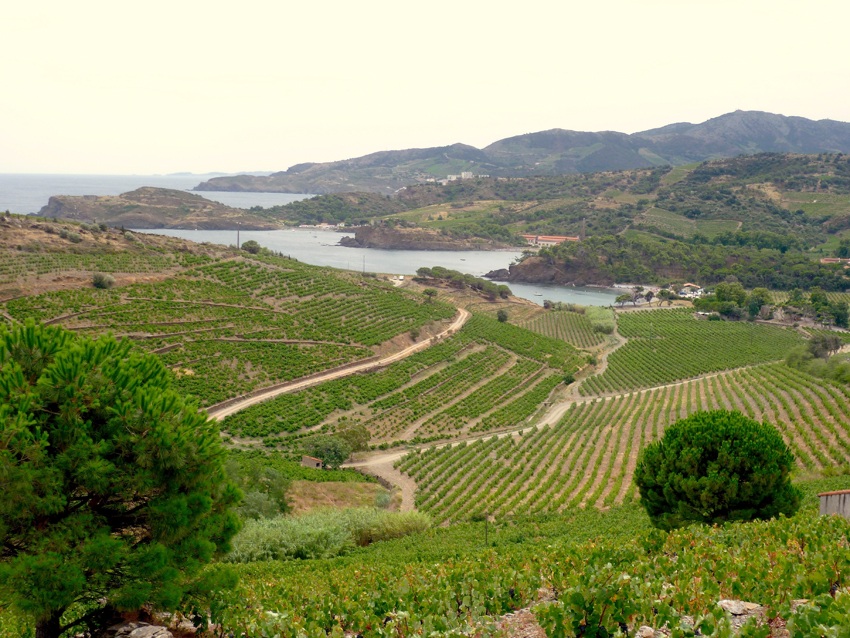 The surrounding Hills are the location of some good ’terroirs’ where some good wine is produced, a.o. Taichat and some other domains
Cap Castell (42°30’N., 3°08’E.) is located 0.5 mile N of Cap Dosne and fronted by a detached perpendicular rock. Cap Oullestrell, a rugged and prominent headland, is located 0.5 mile N of Cap Castell. Anchoring is prohibited within 500m of the NE extremity of this cape.
Anse de Paulilles, a small bay, lies between Cap Oullestrell and Cap Bear, 1 mile NNE. A dynamite factory stands on a sandy beach at the head of this bay. An iron pier, with a depth of 5.5m at the outer end, fronts the factory. The bay offers shelter from N winds, but is exposed to heavy swell. The holding ground is mostly sand, except for Roche La Lioze, a rock, with a depth of 4.7m, which lies in the middle of the bay.
 On the South Side of Cap Béar lies the Anse de Paullile, a beautifull bay with a nice beach and with good anchoring possibilities.